Swiss glaciers
An eternal world of ice?
- Naturwissenschaften
Just imagine: 100 years from now, there will only be two glaciers left in Switzerland. A horror scenario? Glaciers are not new to the public and academic debate on climate change and the glacial melting it entails, however. The first exploration on the icy mountains of the Swiss Alps was conducted back in the 16th century, as early travelogues reveal. Based on selected themes, discover the evolution of glaciology and how changes can be traced thanks to historic documents and current data. Research on glaciers – especially in Switzerland – also enjoys a long tradition at ETH Zurich.
Fairies and evil spirits – Dispelling myths about glaciers
“And in the glaciers, lying there so silently in the pale moonlight, the crevices begin to yawn and gape like wide-open fishmouths; the snow gleams in the walls as if one could actually see its iciness, and everything is so monstrous in the knowledge that there is a human out there, somewhere in one of these walls, where there is no forwards and no backwards; merely this deadly cold space.” 1
— Max Frisch
Modern science defines glaciers as “masses of grainy, porous firn and crystalline, dense ice”. 2 In popular literature, however, they have been regarded as a separate, unspoilt world within the Swiss Alps, observed from a distance yet feared as an other-worldly place, inhabited by fairies, evil spirits and the devil himself. No wonder this mythical ice world is woven in myths, fairy tales and legends in Switzerland and all over the Alpine region. 3 Eventually, however, scientists and artists began to question the “glacier” myth and travel the snow-white country.
The statesman Aegidius Tschudi (1505–1572) and the humanist Sebastian Münster (1489–1552) were among the first people to attempt these arduous journeys and wrote the oldest descriptions of Swiss glaciers. Then, in the 18th century, the Zurich-born Enlightenment philosopher Johann Jakob Scheuchzer (1672–1733) took a major step in glacier research. He travelled the Alpine region systematically and wrote down his observations on the Rhône Glacier and the Upper and Lower Grindelwald Glaciers in travelogues. 4 These reflections were subsequently deemed seminal for the development of glaciology. 5 Scheuchzer has been regarded as the father of the dilatation theory ever since. 6 By present-day standards, as soon as they were published, Scheuchzer’s travelogues, and especially the maps of Switzerland they contain, effectively served as a marketing campaign: through his works, Europe discovered Switzerland as a tourist country. 7
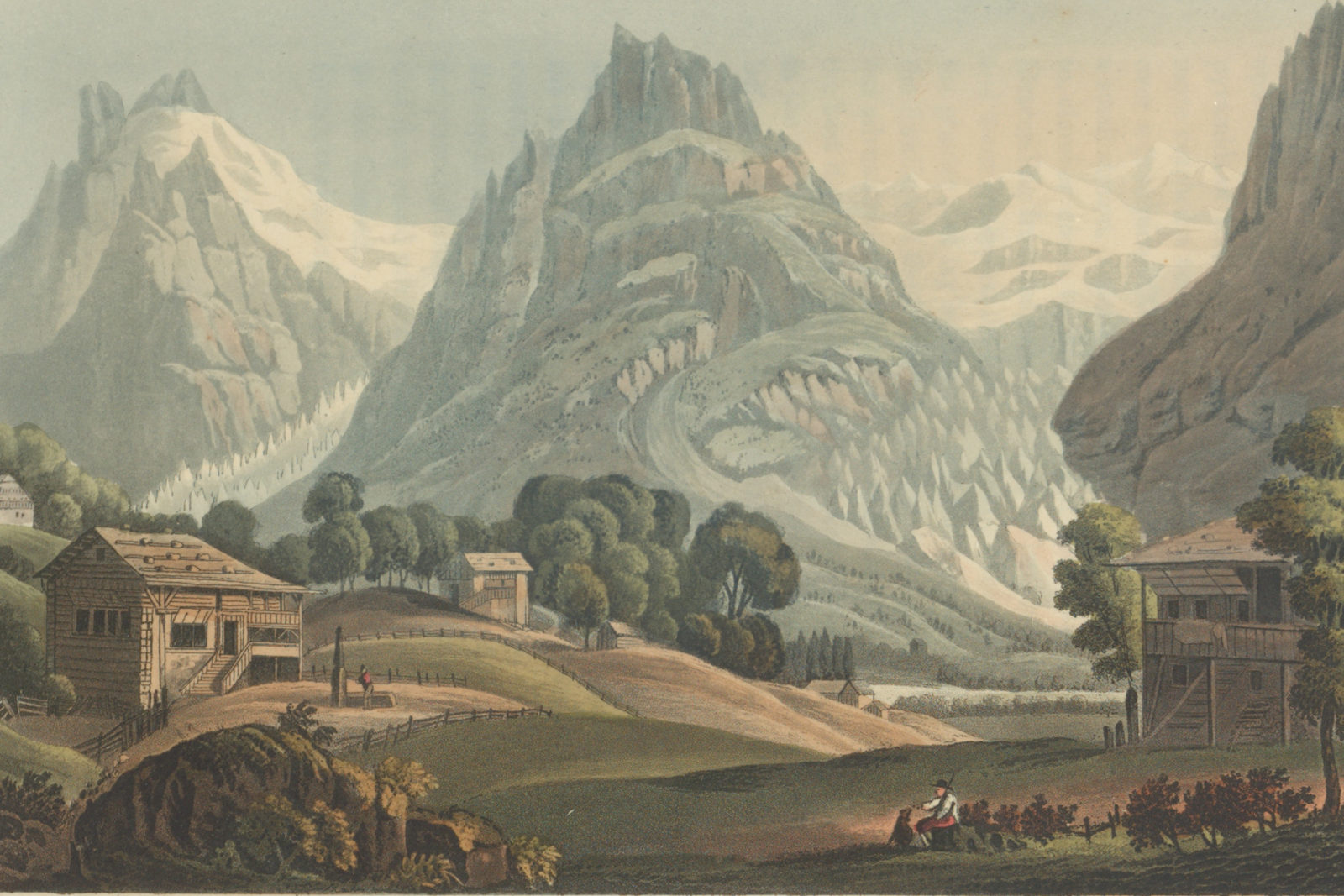
From the mid-18th century, influenced by romanticism and the call “back to nature”, tourists and mountaineers began to flock to Switzerland and its Alpine world. The age of mass tourism had begun and trips to the glaciers were packaged as romantic mountain experiences. The travel bug also prompted the first signs of the urbanisation of the glacier world: Alpine chalets and hotels made the isolation of the vast mountains of ice more tolerable.
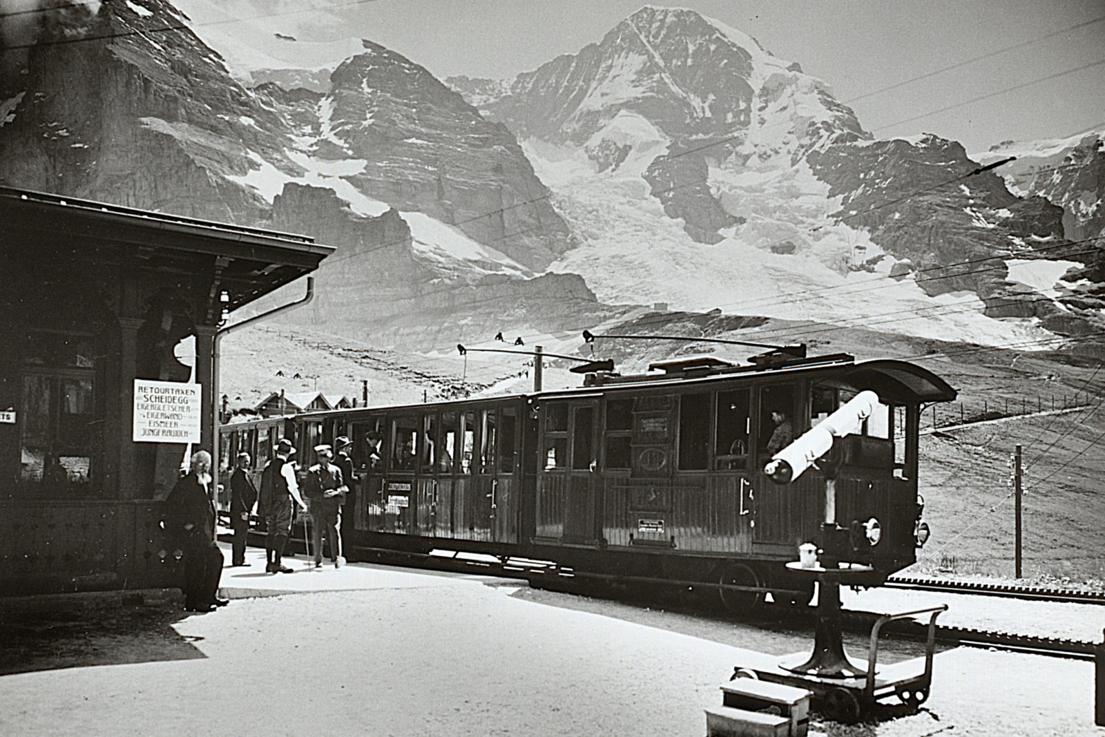
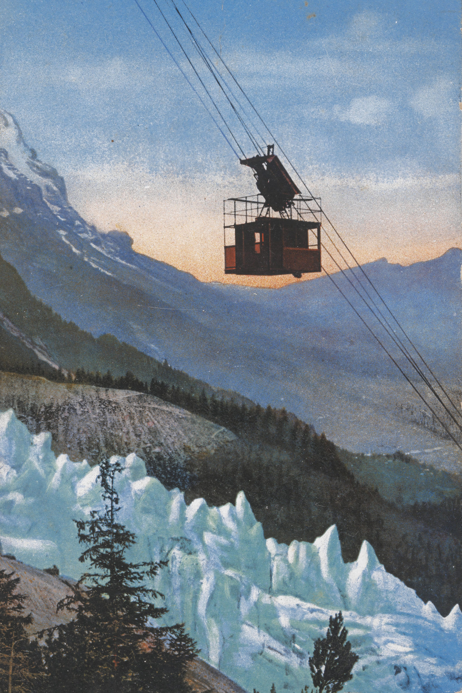
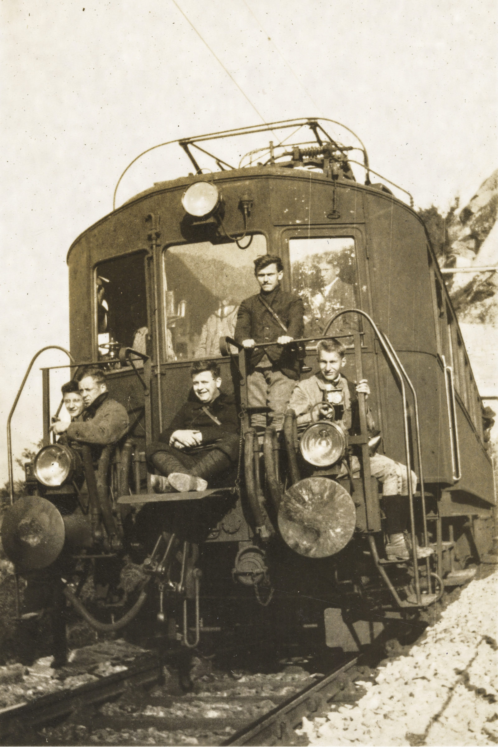
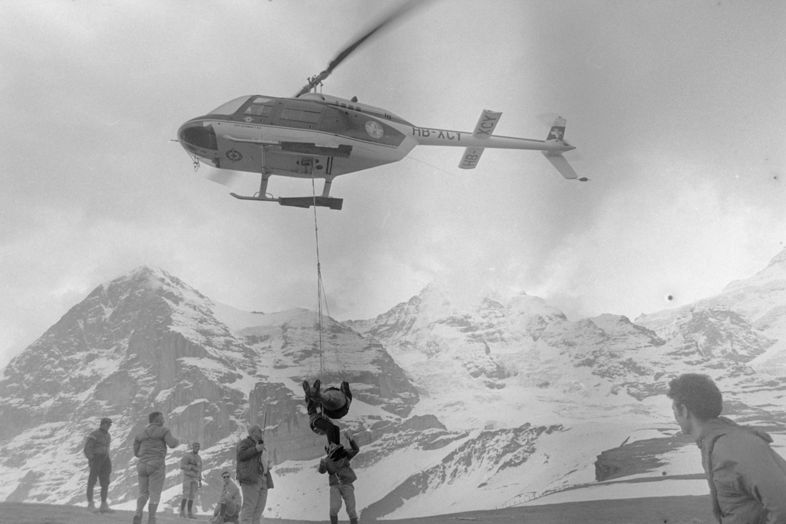
Ever since the 19th century, railways, cable cars and later even helicopters have conquered the paths up to the glaciers, which could now be reached swiftly and comfortably.
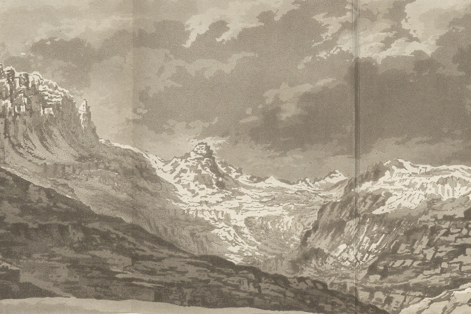
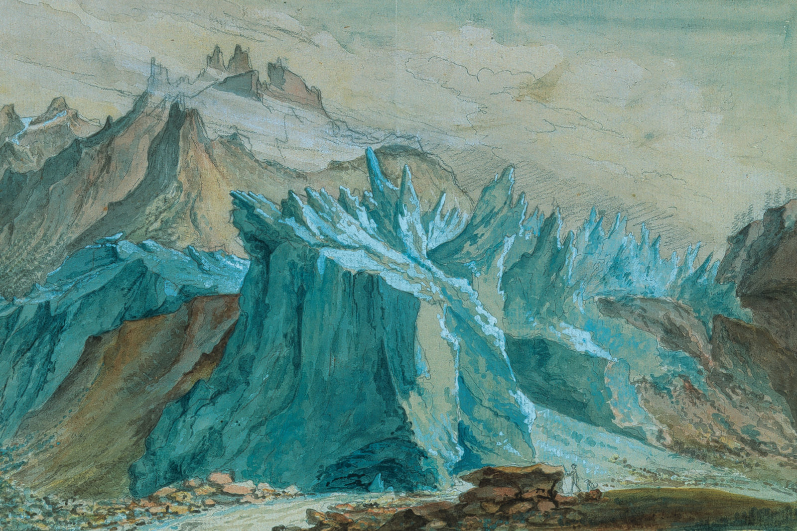
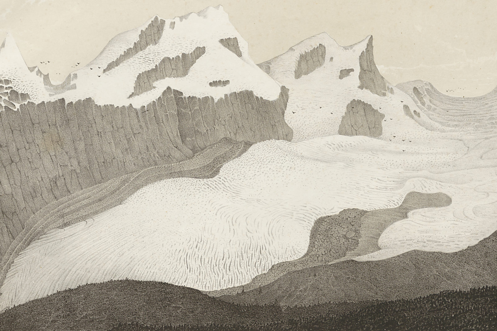
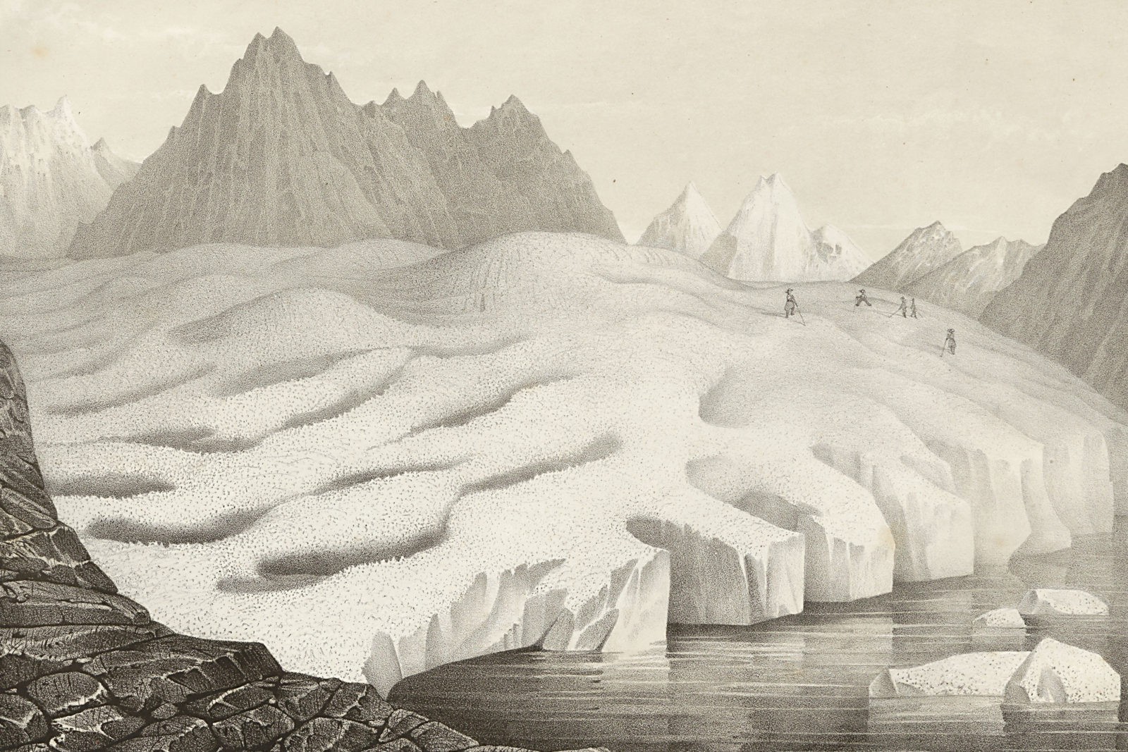
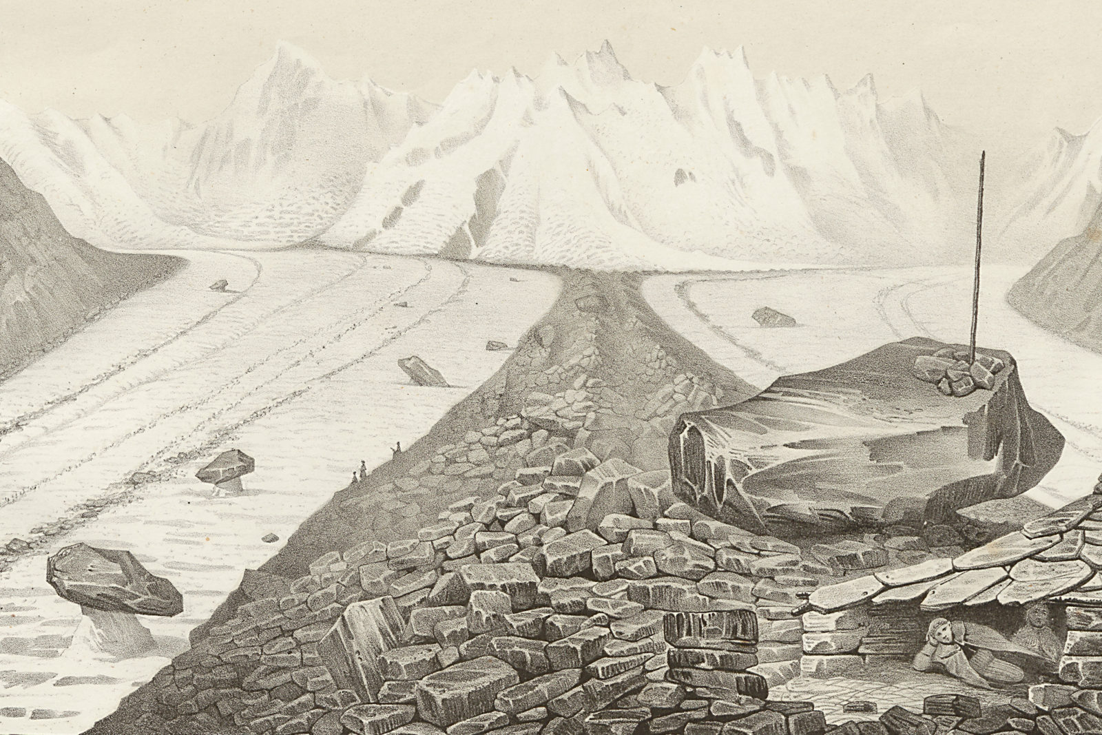
Thanks to early artworks, paintings and illustrations in travelogues are still regarded as valuable historical documents today. For instance, the Swiss landscape painter Caspar Wolf (1735–1783) chose glaciers as the theme in 32 of his impressive paintings. In order to paint them, he would venture on perilous expeditions into the Swiss Alpine world. 8
Numerous travelogues were also illustrated with drawings by the two well-known Swiss artists Gabriel Lory the Older (1763–1840) and son (1784–1846). Gabriel Lory the Younger published a selection of his glacier drawings in “Picturesque Tour through the Oberland in the Canton of Berne, in Switzerland”, which was published in London in 1823. 9 As the illustrations spread, the academic interest in glaciers and the Alpine environment grew. 10
Glaciers as a research discourse – Early theories and the breakthrough of glaciology
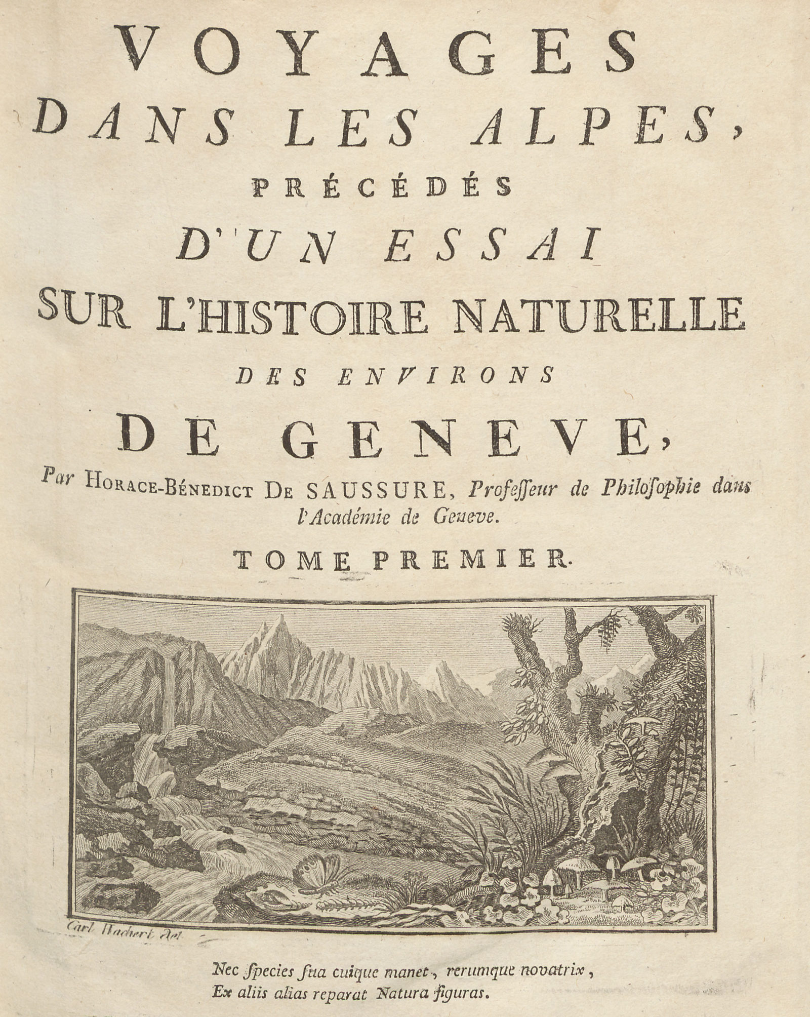
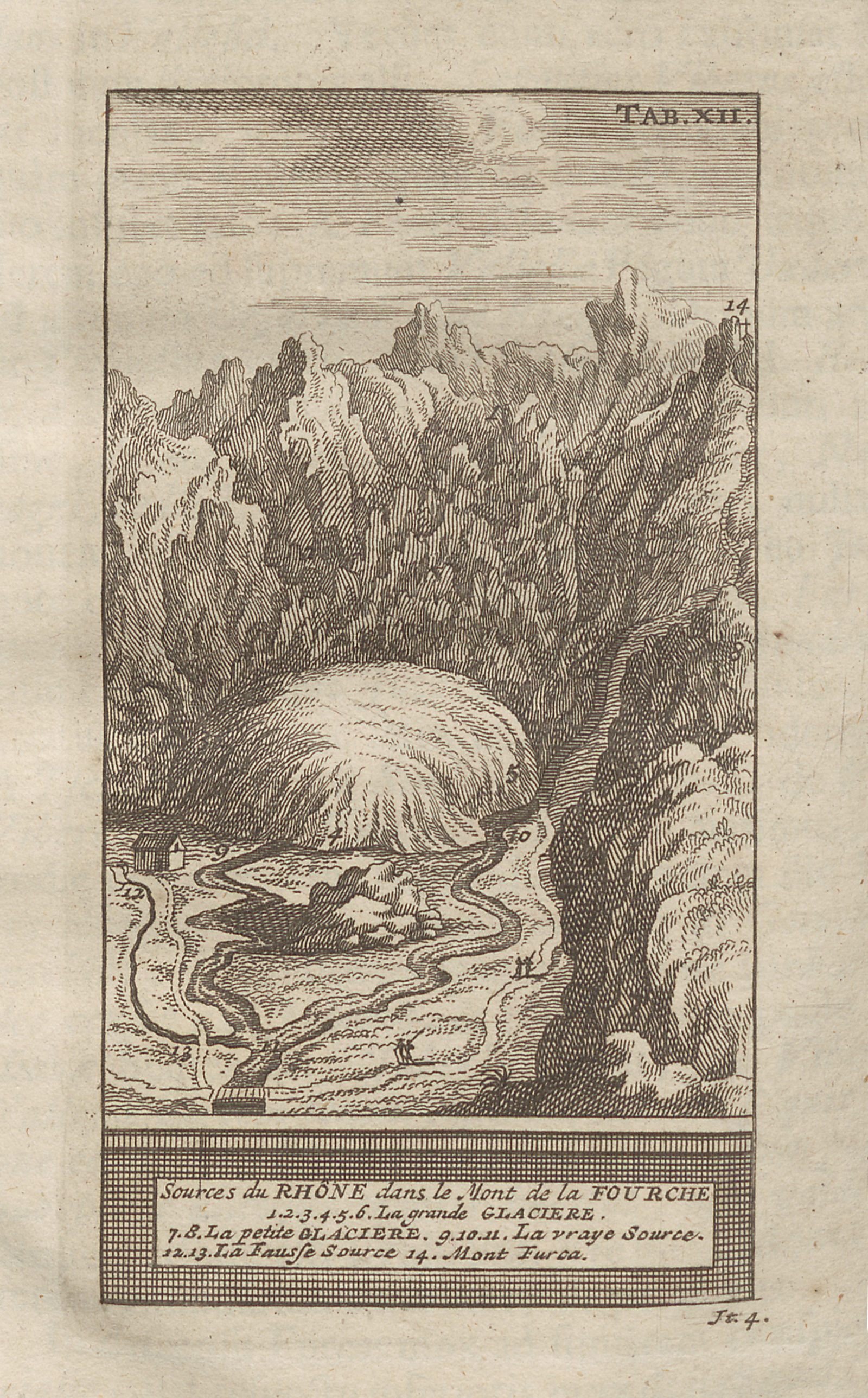
As glaciology and mountaineering were already inseparable, the pioneers of scientific glacier research continued to write and publish their observations in the form of travelogues. For instead of lab work, researching glaciers means a dogged confrontation with the rugged ice masses. One of the first modern glaciologists was Professor Horace Bénédict de Saussure (1740–1799) from Geneva, who ventured on several research expeditions and published his observations and measurements in the work “Voyage dans les Alpes”.
Furthermore, the Swiss researcher trio Ignaz Venetz (1788–1859), Jean de Charpentier (1786–1858) and Louis Agassiz (1807–1873) first deepened glaciological discourse with the question of the Ice Age. Ignaz Venetz championed the notion of an ice age, which was subsequently recognised in science by Jean de Charpentier and Louis Agassiz. This theory triggered great excitement among the researchers. From that moment on, new theories were no longer written as travelogues, but rather defended on the scientific stage. 11 The publication of Agassiz’s work “Études sur les glaciers” in 1840 finally marked the breakthrough of glacier research.
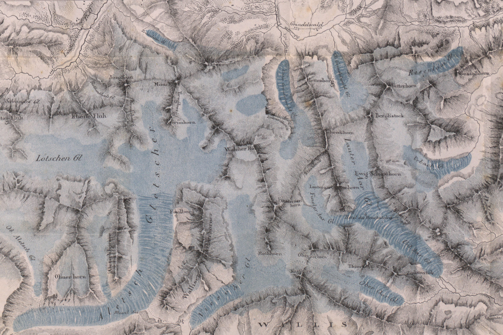
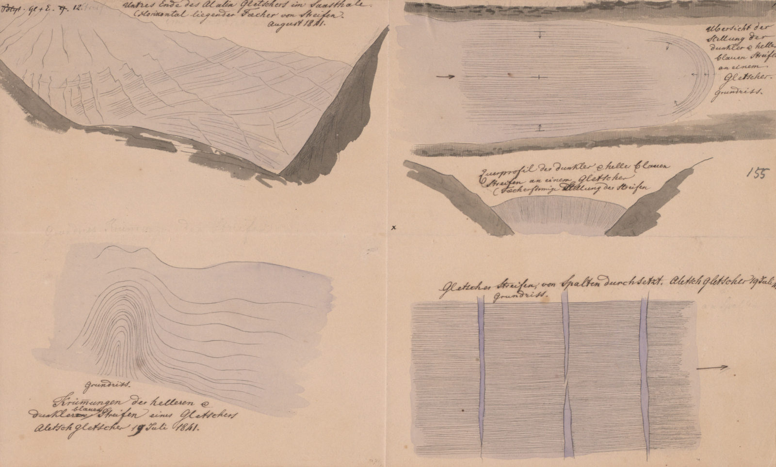
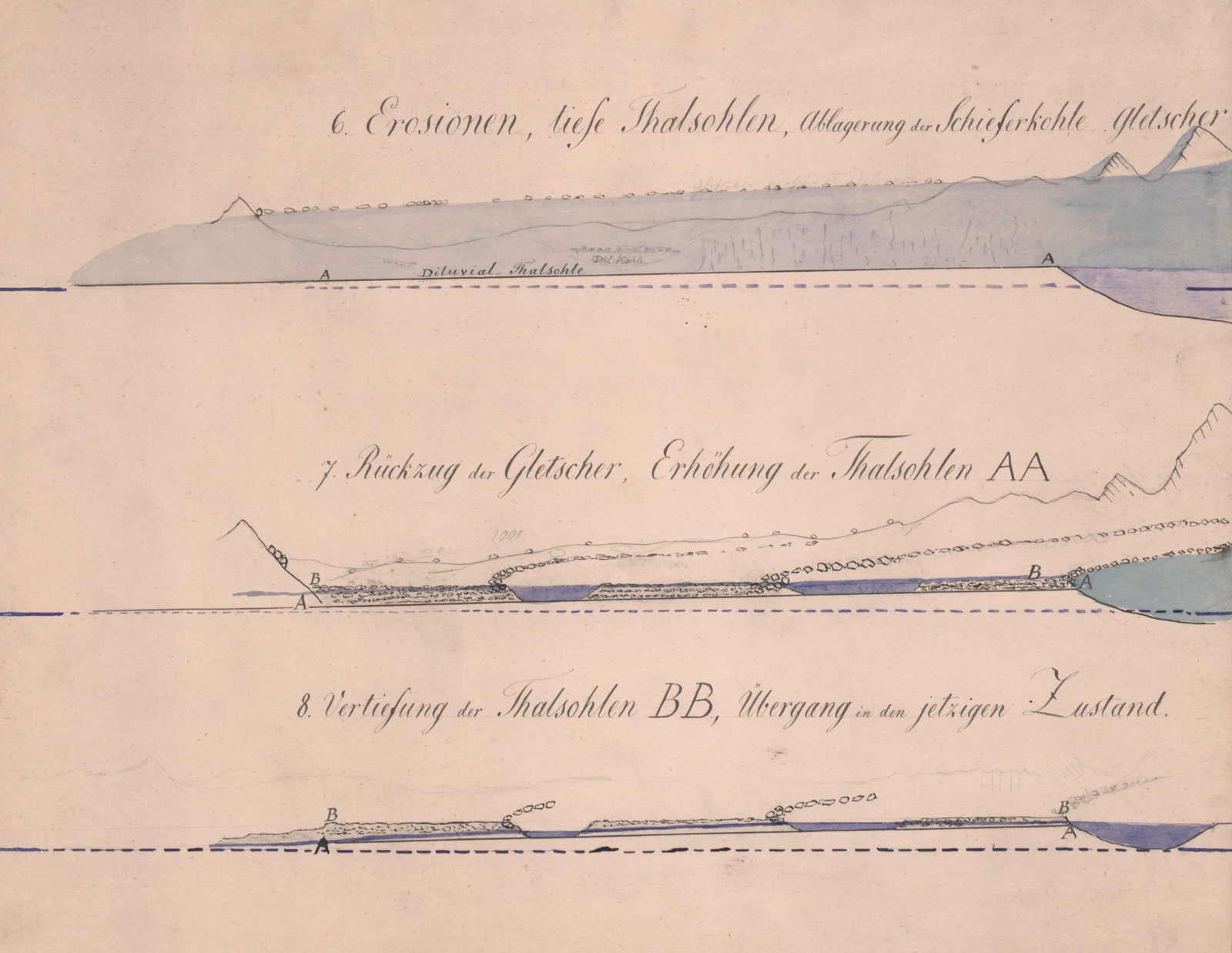
ETH Zurich professor Arnold Escher von der Linth (1807–1872) 12 was also one of the “forefathers” of Alpine geology. During numerous study excursions, he documented his research observations with extensive hand-drawn maps and drawings of Swiss glaciers. This early research data still constitutes a valuable source for glaciology to this day.
With his scientific endeavours, Arnold Escher von der Linth paved the way for future glacier research at ETH Zurich. His student and protégé Albert Heim (1849–1937) followed in his footsteps as a passionate geologist. 13 Heim also devoted his research to glaciers and published his results in 1885 in his seminal work “Handbuch der Gletscherkunde”.
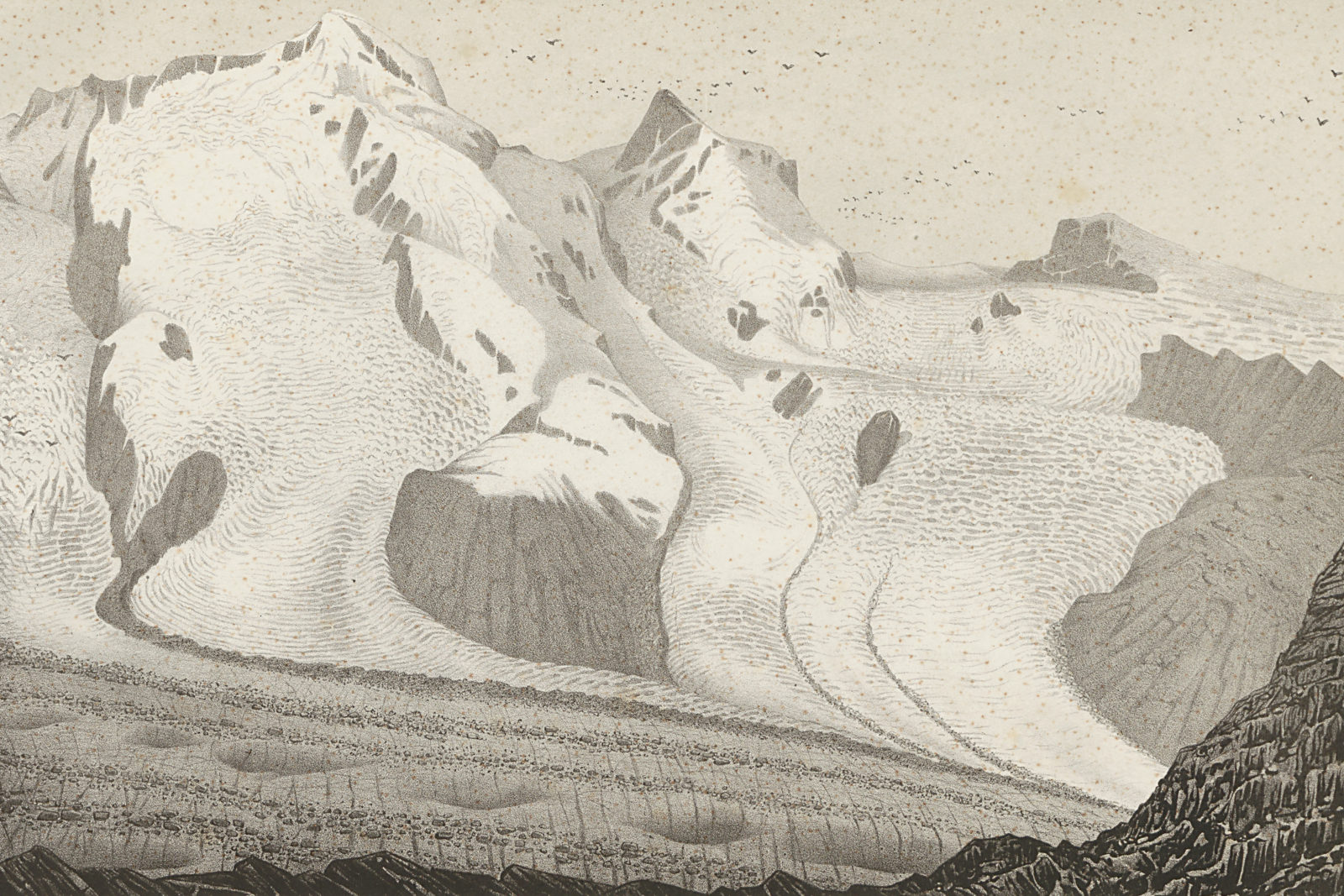
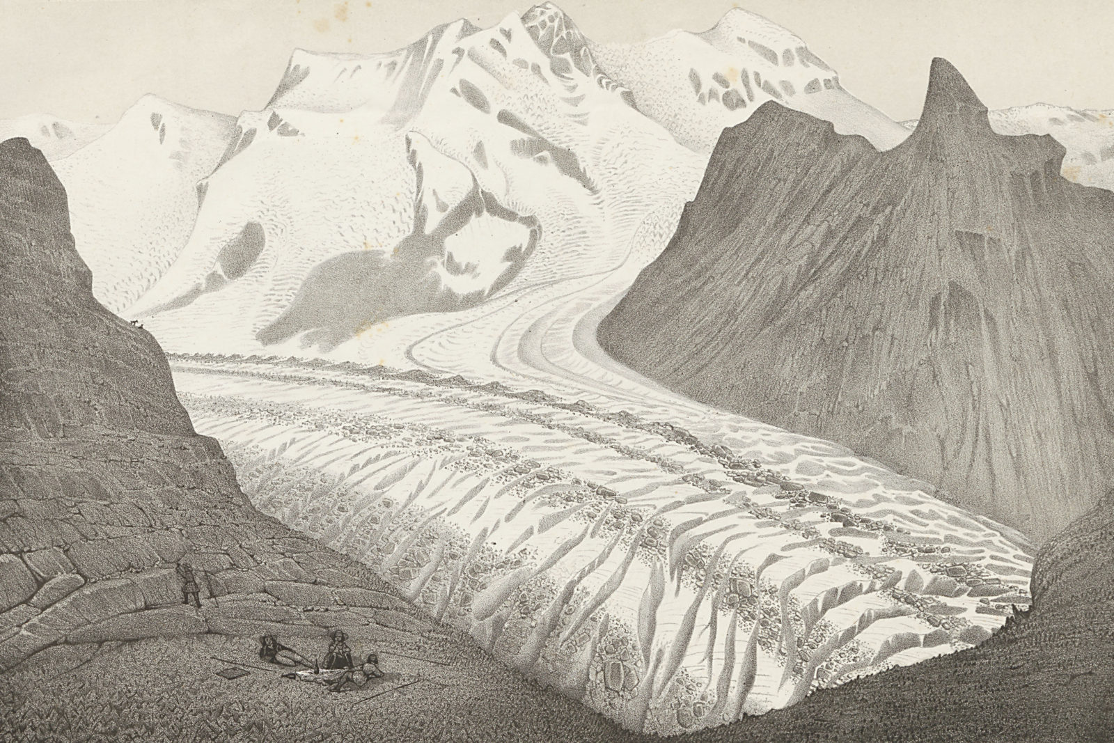
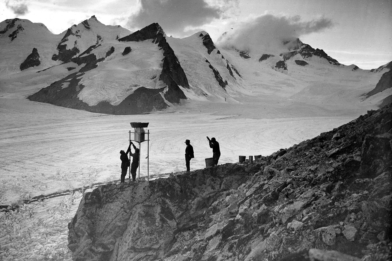
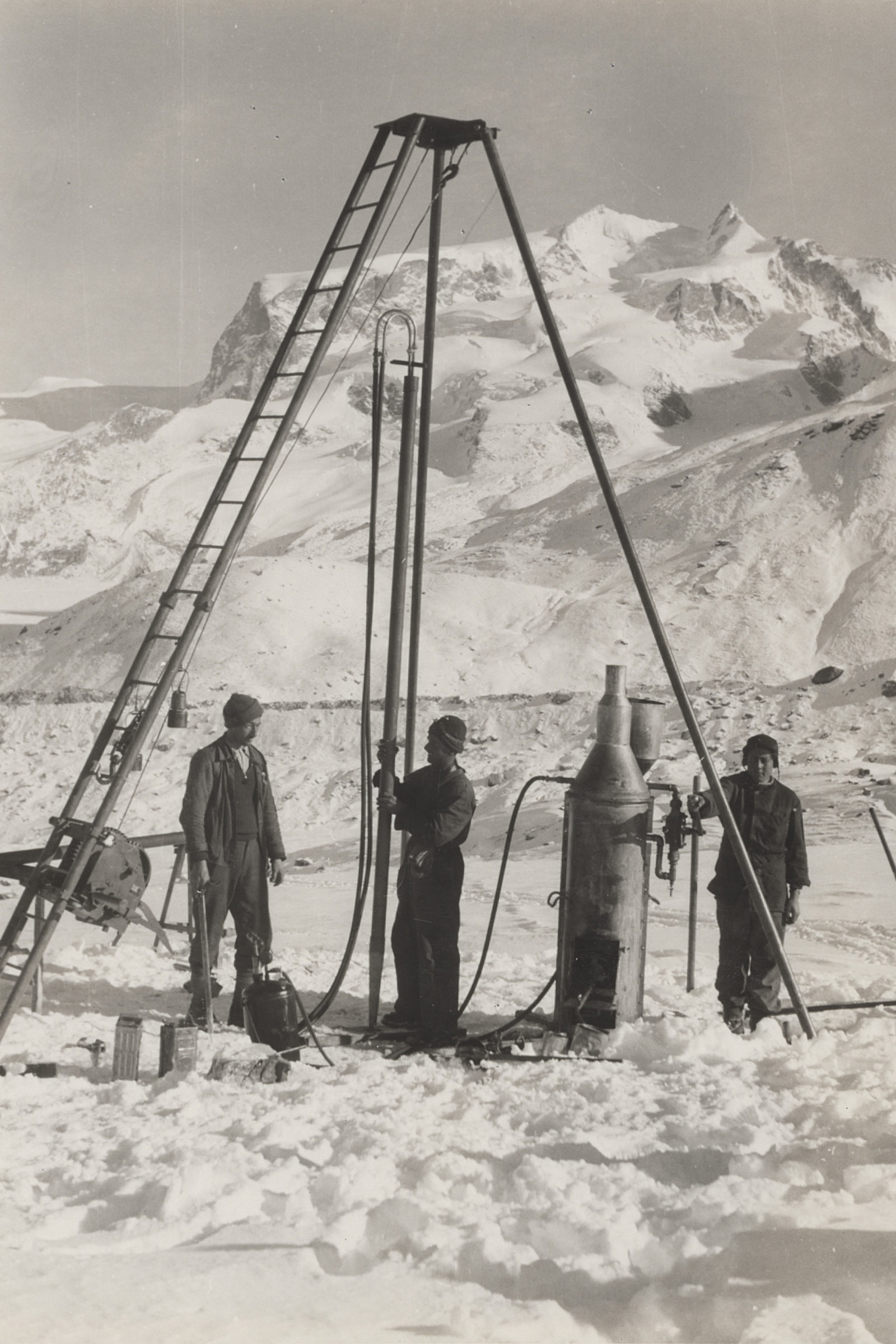
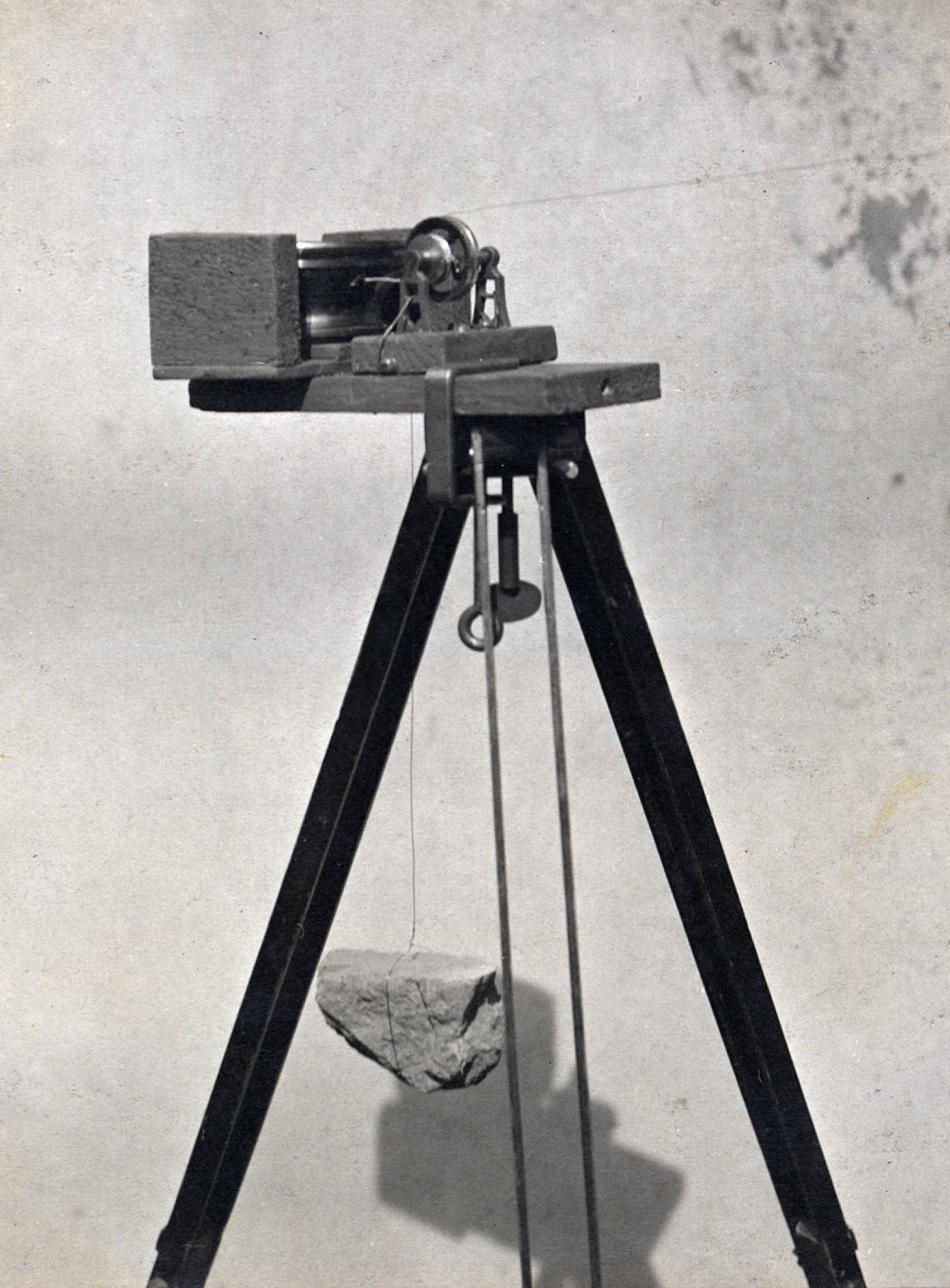
Ice picks, sound waves and drills – The measuring methods used in glaciology
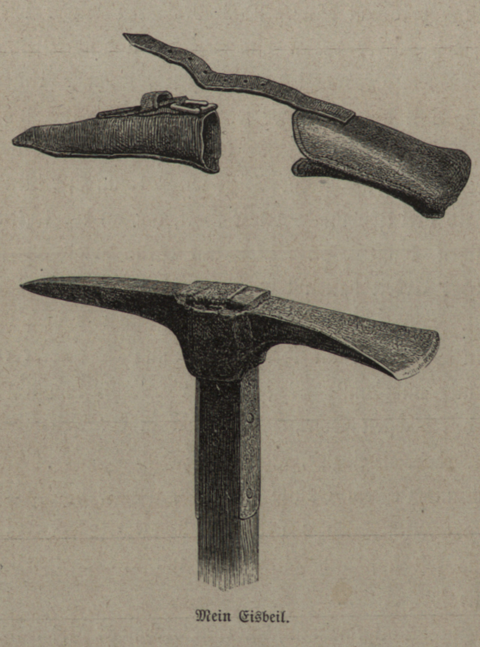
In order to observe and research changes in the glacier world, the ice masses are still regularly measured, probed and analysed using drills to this day. The pioneers of glacier research, however, merely had ice picks and mountaineering ropes at their disposal. Edward Whymper, who famously became the first mountaineer to climb the Matterhorn, had his ice axe illustrated in his book “Berg- und Gletscherfahrten in den Alpen in den Jahren 1860 bis 1869”.
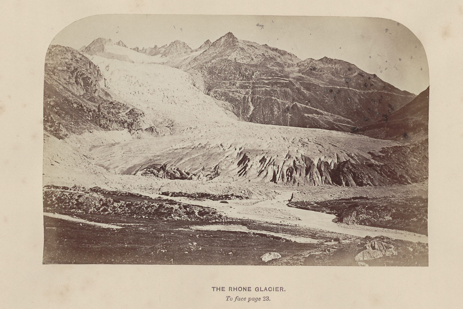
The camera was already used as a tool in the 19th century. Ernest Edwards was the trailblazer when it came to photographing ice worlds. His pictures were published by H. B. George in his work “The oberland and its glaciers”. 14
Modern cameras enabled ever sharper and more precise shots, from which glaciologists can extrapolate information about the glaciers’ development over a long timespan.
Technological progress led to increasingly more accurate and efficient instruments. Using theodolites, measurements can be made on the surface of the ice nowadays. And sound waves are used to determine the thickness of the ice. Much like a sonar, they are sent deep into the ice, where they are reflected and recorded back at the surface. Drills and probes, which the pioneers still had to carry out manually, are performed by machines these days and precipitation gauges permanently record the amount of rainfall.
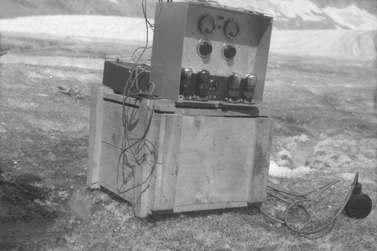
With the advent of the computer and digital measuring devices, it was suddenly possible to collect, evaluate and analyse glaciological research data on an unprecedented scale as regards precision and data quantities. 15
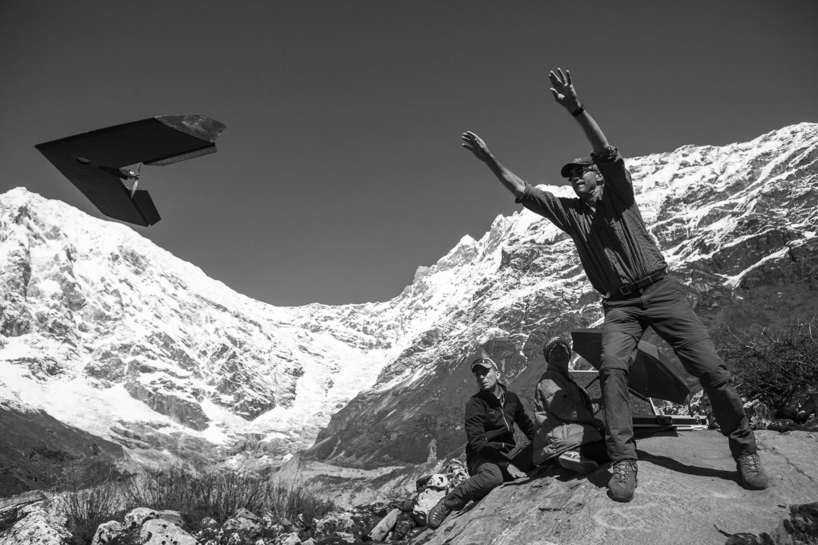
Researched from the air – New models thanks to geodata
Glacier research has been closely linked to cartography ever since its early days as a scientific discipline. Glacier edges were (and still are) recorded on maps and glacier inventories established. 16
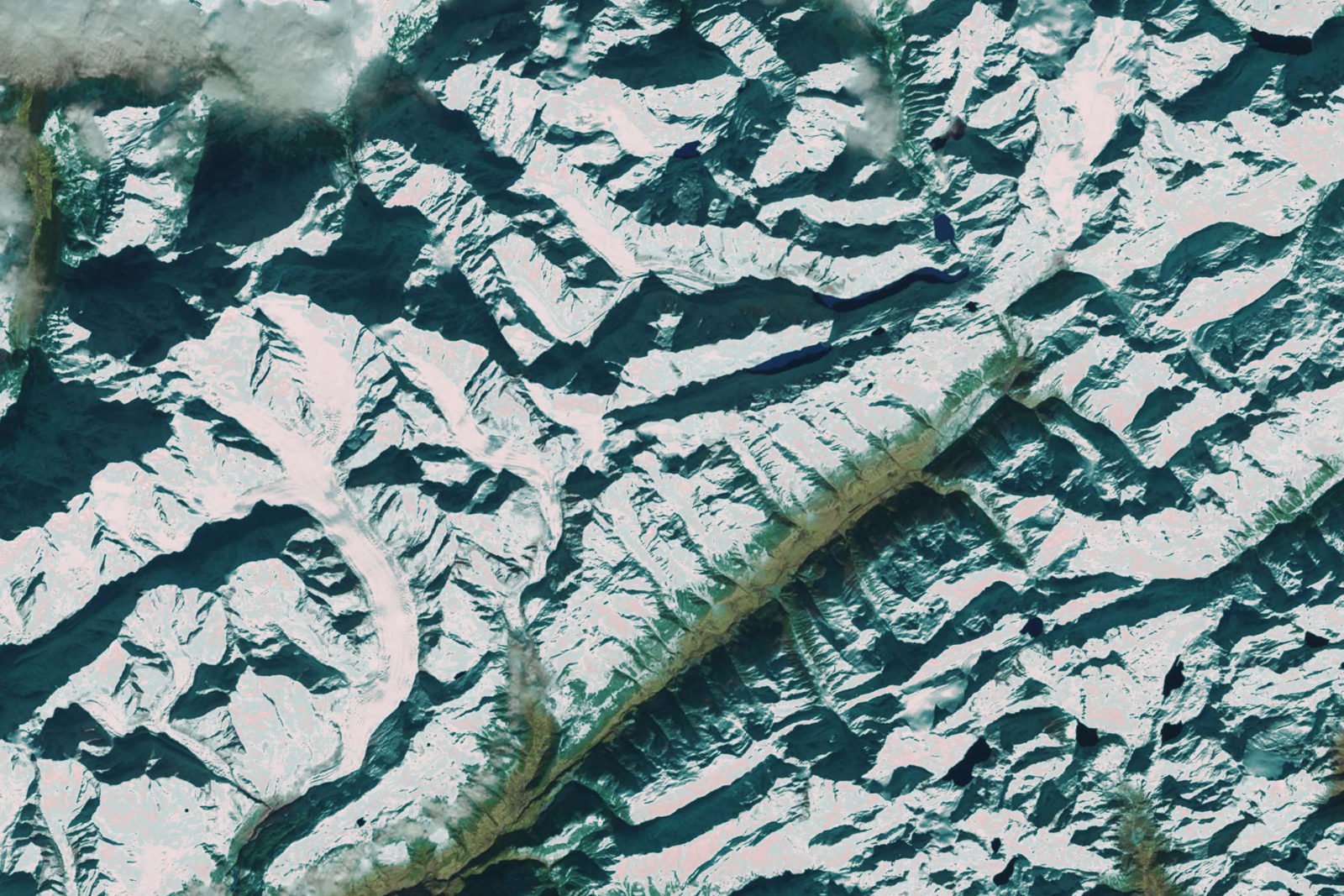
Today, changes in glaciers can be observed based on measuring points via GPS, radar or satellite images. However, measurements “in the field” are as important as ever: researchers increasingly use what are known as “unmanned aerial vehicles”, or UAVs (also drones), which fly over the glaciers and measure them as aerial images as well as via laser or radar readings. 17 A combination of glacier data with existing geodata sets, such as the elevation model swissALTI3D 18 in Switzerland, is then used to model the glaciers.
A combination of analysis methods and data is normally used to reconstruct the progression of glaciers digitally. This includes cartographic products such as topographical maps (up to around 1970) and increasingly also satellite images, such as from the Landsat programme. 19 The edges of the glaciers are extracted from the satellite images taken at different time spans and a volume is calculated in combination with the elevation models available.
Future scenario – Switzerland without glaciers?
The melting of the ice masses is a hot topic, intensely debated in the public eye via all media channels. Future scenarios of a Switzerland without glaciers are presented with a view to raising awareness. And authors are also joining in.
Scientists are also raising the red flag: Switzerland’s glaciers will have melted away in 100 years’ time. Current science rules out absolute protective measures, but is optimistic about damage-limiting solutions.
Footnotes
- Quote from Max Frisch’s Antwort aus der Stille. Eine Erzählung aus den Bergen, 1937, p. 128. Frisch penned this early work at the age of 26. It tells the story of a young teacher who wants to burst through the normality of his life with a “manly act”. He sets off on a perilous mountain hike, is presumed lost for three days and returns a changed man. Later, perturbed by the story’s melodramatic composition, the author made sure the book vanished from the bookshops for many years – until 2009, when the publishing house Suhrkamp Verlag published a new edition in collaboration with the Max Frisch Foundation. It reveals how Frisch already had forged a central theme of his later works early on: is there self-fulfilment outside an artistic existence? ↩︎
- Gletscher, Schnee und Eis. Das Lexikon zu Glaziologie, Schnee- und Lawinenforschung in der Schweiz, Lucerne 1993. See also: Hans Murawski, Wilhelm Meyer: Geologisches Wörterbuch, Berlin, Heidelberg 2010, p. 63. Online at: https://link.springer.com/book/10.1007%2F978-3-662-54050-3 [23.11.2017]. ↩︎
- Johannes Jegerlehner: Sagen und Märchen aus dem Oberwallis. Aus dem Volksmund gesammelt, Basel 1913; Josef Guntern: Volkserzählungen aus dem Oberwallis. Sagen, Legenden, Märchen, Anekdoten aus dem deutschsprechenden Wallis, Basel 1979; Peter Egloff: Die Kirche im Gletscher. Rätoromanische Sagen aus der Surselva, Zurich 1982; Peter Keckeis (ed.): Sagen der Schweiz. Graubünden, Zurich 1986; Christian Caminada: Die verzauberten Täler. Die urgeschichtlichen Kulte und Bräuche im alten Rätien, Chur 2006. ↩︎
- Johann Jakob Scheuchzer: Natur-Geschichte des Schweitzerlandes samt seinen Reisen über die Schweitzerische Gebürge, Zurich 1746 (ETH Library, Rare Books, Rar 5734); id.: Ouresiphoites Helveticus, sive, itinera per Helvetiae alpinas regiones, Leiden 1723 (ETH Library, Rare Books, Rar 5806). ↩︎
- Christine Reinke-Kunze: Die PackEISwaffel. Von Gletschern, Schnee und Speiseeis, Basel 1996. ↩︎
- This glacier theory attributes glacier movement to the expansion of the permeating, freezing water in cracks or hollow spaces in the glaciers. Cf. Hans Murawski, Wilhelm Meyer: Geologisches Wörterbuch, p. 64. Online at: https://link.springer.com/book/10.1007%2F978-3-662-54050-3 [03.11.2017]. ↩︎
- Madlena Cavelti Hammer: An Kunstwerken lernen, zum Beispiel: Die Schweizerkarte von Johann Jakob Scheuchzer um 1720, in: Cartographica Helvetica 1 (1990), pp. 29–30. ↩︎
- Heinz J. Zumbühl: “Der Berge wachsend Eis …” Die Entdeckung der Alpen und ihrer Gletscher durch Albrecht von Haller und Caspar Wolf. Special print from “Mitteilungen der Naturforschenden Gesellschaft in Bern”, Vol. 66 (2009), pp. 111–123. ↩︎
- ETH Library, Rare Books, Rar 10433 ↩︎
- Discover further georeferenced historical travelogues through Switzerland on the platform ETHorama: http://ethorama.library.ethz.ch/en/routes ↩︎
- Rhetorical and controversial debates were held within the scope of the conferences of the Swiss Academy of Sciences and the British Association for the Advancement of Science in Glasgow. Cf. Edmund Blair Bolles: Eiszeit. Wie ein Professor, ein Politiker und ein Dichter das ewige Eis entdeckten, Berlin 2000. ↩︎
- Cf.: http://www.library.ethz.ch/en/Ressourcen/Digitale-Bibliothek/Kurzportraets/Arnold-Escher-von-der-Linth-1807-1872 [14.11.2017]. ↩︎
- He was appointed as Arnold Escher von der Linth’s successor as a professor of technical and general geology at the Polytechnic School (now ETH Zurich). Cf.: http://www.library.ethz.ch/en/Ressourcen/Digitale-Bibliothek/Kurzportraets/Albert-Heim-1849-1937 [14.11.2017]. ↩︎
- ETH Library, Rare Books, Rar 3428 ↩︎
- Scientists from the Laboratory of Hydraulic, Hydrology and Glaciology (VAW) at ETH Zurich use state-of-the-art instruments in Switzerland. Data on glaciers has been compiled, analysed and published constantly for over forty years. The resulting research database is the most extensive in the world. In glaciology, like in many other scientific disciplines, recording series of measurements over long periods of time is crucial. Research data can be evaluated time and again in a vast range of respects and for various issues. Researchers keep conducting deeper data analyses with increasingly more efficient hard and software. ↩︎
- Mauro Fischer et. al.: The new Swiss Glacier Inventory SGI2010: Relevance of using high-resolution source data in areas dominated by very small glaciers. In: Arctic, Antarctic, and Alpine Research 46 (4), 2014, pp. 933-945. Online at: https://doi.org/10.1657/1938-4246-46.4.933 [23.11.2017]. ↩︎
- Mauro Fischer et. al.: Surface elevation and mass changes of all Swiss glaciers 1980–2010, In: The Cryosphere 9, 2015, pp. 525-540. Online at: https://doi.org/10.5194/tc-9-525-2015 [23.11.2017]. ↩︎
- Thierry Bosshard: Evaluation of SwissALTI3D with Airborne Laser Scanning Data for Applications in Glaciology: A Case Study on Glaciers in the Upper Mattertal, Switzerland. Master's thesis. Zurich: 2014. Online at: http://www.library.ethz.ch/DADS:default_scope:ebi01_prod010223095 [23.11.2017]. ↩︎
- A.D. Kitov and V.M. Plyusin: The database and GIS analysis of the status of glaciation of the Kodar Mountains (Northern Transbaikalia). In: Geography and Natural Resources 38 (2), 2017, pp. 181–187. Online at: https://doi.org/10.1134/S1875372817020093 [23.11.2017].
Mărgărit M. Nistor et. al.: Advance in glacier modelling: GIS and oriented programming approach applied on Whittier Glacier, Alaska. In: Applied Ecology and Environmental Research, 15 (1), 2017. Online at: http://dx.doi.org/10.15666/aeer/1501_649663 [23.11.2017].
Roland Wastlhuber et. al.: Glacier Changes in the Susitna Basin, Alaska, USA, (1951–2015) using GIS and Remote Sensing Methods. In: Remote Sensing, 9 (5), 2017, S. 478. Online at: http://dx.doi.org/10.3390/rs9050478 [23.11.2017]. ↩︎ - Mărgărit M. Nistor et. al.: Advance in glacier modelling: GIS and oriented programming approach applied on Whittier Glacier, Alaska. In: Applied Ecology and Environmental Research, 15 (1), 2017. Online at: http://dx.doi.org/10.15666/aeer/1501_649663 [23.11.2017]. ↩︎